The Village
The village is centred on the High Street where there is a Post Office [now
closed], a pizza takeaway [now closed] and Melanie's Hairdressers; and the
adjoining Bishops Road where there is a Primary School and a village hall.
St Barnabas Church is at the top of the High Street and the Free Church is
situated in Claverham Road, a few hundred yards from the cross roads. This
cross road, formed by the High Street, Chapel Lane, Bishops Road and
Claverham Road is believed to be the site of the ancient Stalling's Cross - the
market cross for Court de Wyck. (The former Chapel is thought to stand on
the original site). Stalling's Cross may have been corrupted to become Stream Cross.
Originally a farming hamlet, the village acts as a home to
many commuters. However, it still retains its rural heritage
and is surrounded by farms, horticultural businesses, market
gardens and a small riding school. It is this patchwork of
farms, fields, footpaths and winding lanes that gives
Claverham its character.
As with many villages in North Somerset, Claverham has a
mixture of old local families and new arrivals.
History
Claverham is probably named after the clover fields which surrounded the village. In the West
Country, the word 'ham' does not refer to a village or settlement, but is a contraction of the word
'hamm' meaning meadow.
It is situated roughly half way between Weston-super-Mare and Bristol on the plain between the
rivers Kenn, to the north, and Yeo to the south. Claverham is roughly five miles from the Bristol
Channel as the crow flies.
The village has two distinct geological sections. To the south Cadbury
Hill, a limestone ridge, partly overlaid with clay, rises to some 250
feet. The rest of the area is a mixture of peat, estuarine alluvium and
low hills of sand and gravel. The former swampy areas between
Hillsea, Claverham Court and Claverham Road were drained by an
interconnecting series of rhynes in the 1700s.
The underlying geological structure has determined the development
pattern of the village - but it is the impact of man, allied to the natural environment, which has
given the surrounding countryside its patchwork of fields, hedges, walls and rhynes.
Formation of the Village
Claverham has probably been inhabited from Stone Age times when the moors would have been
used for fishing and wild fowling. Trenches cut in the 1970s at Kenn revealed pieces of wood
thought to have come from a track-way across the swamp. A Romano-British pot was found south of
the railway line at Hillsea and Saxon pottery has also been found in the area.
Although not strictly speaking in Claverham, there was a Roman Temple and an Iron Age Fort on
Cadbury Hill. Prior to the Roman period (around 45AD) the area was mainly used for grazing, fishing
and hunting. Drainage systems put in by the Romans, however, established a suitable environment
for agriculture.
Early history is sketchy. Before 1066 Claverham was held by Gunhilda. After the Norman Conquest
it was held by the Bishop of Bath and Wells. At the time of the Doomsday survey, 'Claverham' was
home to one Lord, one slave, three villagers and twelve smallholders. By 1450 there were 14
farms.
The village was originally in two hamlets or tithings. The tithing of
'Claverham' was the area now known as Lower Claverham and
centred round Claverham Court, while the High Street area was
called 'Week' and centred round Court de Wyck. More recently, a
third hamlet has grown up in the Stream Cross area. Claverham
Court, originally the old Court House, now a farm, was built in the
15th century or possibly even earlier.
A medieval two-light stone window still exists at the back of the hall. The house has a historic 17th
century park and gardens. To the east of the house stands the original 15/16th century Tythe Barn,
with its central cart entry and weathered buttresses. Nearby is a purpose built sheep wash.
The original Court de Wyck was built before 1338. Between 1660 and 1670 it was enlarged and at
the beginning of the 18th century it was considered one of the most magnificent properties in the
area. However by 1814 it was virtually uninhabitable and was pulled down leaving only the l4th
century chapel and the tythe barn intact.
The tythe barn was converted into a tannery in 1840. In 1970 it was taken over by The Imperial
Tobacco Co. and its trademark tall chimney, a landmark for miles
around, was demolished in the mid-1970s. The barn was twice
gutted by fire - in 1898 and 1928. After the latter fire the south
fascia was reconstructed from the original stone. Opposite the
original entrance to Court de Wyck was the farmhouse of Bishop's
Farm, first recorded in 1799 as being let to Edward Ash. By 1821
the present house had been built in the "homeground".
Over the next 200 years farm houses and cottages were slowly
added, but the next major change came with the drainage of the low lying, peaty land between
Claverham Court and Little River. In 1750/1 a private agreement led to the early enclosure of some
200 acres at Claverham Common. The enclosure was allocated to people in proportion to the
number of shares (or grazing rights) they held on the Common. The area known as Hare Mead,
some 32 acres, was made into a Decoy Pool. The land was divided into fields enclosed by rhynes,
which act as boundaries, watering for livestock and a drainage system.
The Parliamentary Enclosure Act caused further drainage to take
place. During 1810-1815 Kenn Moor was drained to the west of Kenn
Moor Gate (there literally was a gate here). It was at this time that
the droves, including Claverham Drove (originally called Claverham
Road) were laid out across the moors. Because of the peat
foundation, the roads are laid on faggots, which gives them their
characteristic springy feel.
The census of 1851 shows there were 71 dwellings in the village and 14 farms. Out of 476
inhabitants a quarter were employed in farming. A few were coal miners, who may have worked
down the Claverham mine. There were two shops - a butchers and a
general store. Although there was no inn there was a beer house
keeper near Claverham Green Farm and a cider house keeper at
Mead Mills at the end of Hunt's Lane. The picture "The top of the
High Street" shows the area as it is today, compared with the
picture the early 1900's shown earlier. Eighteen properties were
situated between Cottage Farm at the top of the High Street and
Streamcross Villa. Several remain including Court de Wyck Cottages.
Historic Properties
Claverham is richly endowed with historic properties. Claverham Court is believed to be the
earliest building still existing, but this and some of the other farms were probably built on the sites
of even older properties. They include:
Rose Farm in Stream Cross, was originally a medieval house with an
open hearth. The ceiling, fireplace and stairs were probably added
in the l6th century.
Home Farm (formerly Foord Farm) A 15th century single storey open
hall house, with the smoke escaping through a hole in the thatched
roof. The blackened roof timbers
still remain, but the thatched roof
was replaced in the mid 20th century. Ceiling, fireplaces and
stairs were added in the l6th century.
Lower Farm (formerly Old Farm), Jasmine Lane. This property
dates from mid l6th Century, is built on the same plan and
construction as Home Farm and Rose Farm. Jasmine Lane was
originally called Old Farm Lane. Grove Farm, Brockley Way, is
late l6th/early 17th century with later alterations and additions. It is built of stone and has two
large, external chimneystacks. The gable porch has a very old studded front door with raised
hinges and the doorframe has been cut to allow barrels to be taken into the house.
Claverham Green Farm, Brockley Way: The date on the chimney is 1721, but it is probably of an
earlier construction with 19th century alterations. Built of stone and rendered, the roof is pantiled
with brick chimneys.
Claverham House, Stream Cross: Built in 1744 with mid 19th century alterations, it is built of stone
with a limestone dressing. It has an interesting 19th century porch with pilasters on pedestals. In
the 18th century gardens there is a ha-ha, as have at least three other properties in the village. A
ha-ha is a ditch, often with a low wall inside it, which divides areas of land and forms a barrier to
animals without interrupting the view.
Chestnut Farm, Lower Claverham, The earliest part is mid 17th
century. It was refronted in the 18th century and has early 19th
century alterations. Built of stone and rendered, it has a pantiled
roof and a fine studded door with hinge straps.
Manor Farm, Stream Cross, appears to be early 17th century, but
the hall and stairs in a turret could mean an earlier date. Built of
stone and rendered, with a pantiled roof and gabled
chimneystacks, it has 18th century alterations.
Oakfield, Meeting House Lane: Built in the early 17th century, it was remodelled in the 18th
century and the rear wing was added in the early 19th century.
Construction is stone and render.
Cottage Farm, Brockley Way: Built before 1800 of stone and rendered, the
front has recently been cleared of render and re-pointed. Originally a
single thatched building, it has been added to at the front and rear. In the
19th century there was a coalmine behind the house. The shaft reappeared
during the last war but was filled in to prevent accidents.
White Cottage, Jasmine Lane: An early 19th century front, probably of a much older building, with
20th century alterations. Attached at an angle and incorporated into the house is a former pigsty.
The house is stone, rendered and painted white with a pantiled roof.
The Post Office, High Street: 19th century with the main door originally opening at the side onto
the road. Stone and rendered.
Sweet Briar Cottages, Lower Claverham: Older than 1650, when the
deeds show the property changed hands. Stone and rendered.
Streamcross Villa, Claverham Road: Probably late 18th century
(shown on a survey map of 1799). It is one of the oldest properties
on Claverham Road. Until fairly recently it was a general shop.
Stone built and rendered.
Churches
The earliest known church (or free chapel), which was dedicated to St Swithin, was built near
Claverham Court before 1326. All traces of the building disappeared in the l600s, but it is thought
to have been built on the field called Chappie Hays.
The Friends Meeting House, in Meeting House Lane, was built on a half-acre plot given to the
Friends by Richard Dawson in 1673. This was at a time when persecution of the Quakers was
intense. After the Act of Toleration the Friends obtained a licence to hold meetings in a named
Meeting House. By 1729 the numbers had grown and the House
was rebuilt and extended to create an attractive natural stone
property. (In that same year one of the Friends, Richard Durban
left a bequest in trust for a school in Yatton for poor children). In
1932 the property was given to the Friends Historical Society to
administer. In 1991 a Claverham Trust was set up to buy back the
property and undertake a major building project including re-
rendering the outside. Behind the property is a burial ground.
The Methodist Church at the end of Chapel Lane was built in 1867 It was
closed in 1972 and converted into two properties in 1978.
St. Barnabas Church, which was originally called the Mission Room and Busy
Bee, was built in 1879 on land donated by John Cox and family. A daughter
church of St Mary's, Yatton, it was opened to counter the three 'public houses'
in the remoter parts of Claverham.
The Free Evangelical Church at the corner of Streamcross was built in 1927 -
only eight months after parishioners, who did not agree with the Minister at
the Methodist Church, decided to form their own group. A clubroom was later added at the rear.
Barns and Walls
The village is also rich in old farm buildings, barns and walls made of local stone. Mellowed over
the centuries, they add to the texture of the village. The tythe barn at Claverham Court is
15th/l6th century construction, 17 metres long and stands 7 metres high.
A variety of buildings at Rose Farm show the transition from local stone used in the 18th and 19th
centuries to the brick ones of the early part of the 20th century. At Chestnut Farm, the range of
natural stone buildings, which Include a cider house, run along the side of the road for 80 metres.
Several redundant barns have been converted to attractive homes, thus preserving them. The new
village hall has been built in the style of a Somerset barn to ensure it blends in with the adjacent
historic buildings.
There are also many 'stand alone' stonewalls, the most important being those at Claverham House,
Court de Wyck, Walnut Bank and 'Parman'. The curved garden wall at Walnut
Bank is probably the highest at three metres. The walls adjoining the chapel at
Court de Wyck are probably the oldest in the village. There are several walled
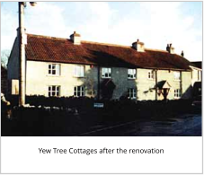
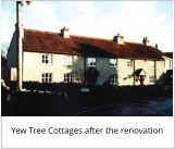
gardens in Claverham. Although the garden wall at Green Farm has been
demolished, the wall outside the refurbished Yew Tree Cottages has been rebuilt
using the original stone.
Up until 1900 the majority of properties in the village were built of dressed
stone or limestone rubble and render, with gables. Recently the render has been removed from
some properties and the stonework re-pointed.
Development
The modern development in the village started in the 1930's with
local authority housing along Claverham Road. These followed the
traditional style of render and gables. Further local authority
housing followed in Broadcroft Avenue, then around twenty years
later in Claverham Park. Again they followed the village style. The
last local authority homes to be added were the retirement
bungalows in 1984, but this time they were brick built.
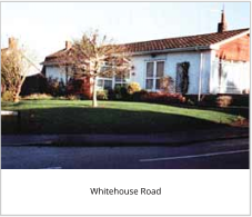
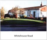
The first private housing developments started in the 1960s. Over
the next ten years, Whitehouse Road, Hollowmead Close, Franklin's
Way, Chestnut Drive, Dunsters Road and Anvil Road were built.
These have followed a variety of styles and are mainly of brick or
imitation natural stone. None of these estates exceeded 35 in
number and the ten-year time scale allowed them to be absorbed
into the village.
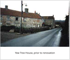
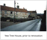
In 1997 five dark red brick houses in Orchard Court were built. This
is a sensitive site right in the heart of the village. Originally the
developers wanted to pull down the three derelict cottages known
as Yew Tree House, which dates from the l6th century or earlier.
However villagers felt that this would destroy the character of the
High Street and after a sustained campaign the planners agreed
they should be retained and renovated.
Strikingly, individual houses which have been built over the past five years, have stuck to the
village style of rendered cottage.
There are a wide variety of properties along Claverham Road and the High Street; all built at
different times and with varying styles, however, several incorporate gables.
Natural Environment
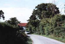
The attractive network of lanes, bridleways and footpaths, which allows access to the countryside
surrounding the village, is one of the reasons why so many people like living in Claverham. Most
properties either look out onto fields or are within easy reach of them. Apart from Claverham
Road, all access roads to the village are through farmland.
Sites of Special Scientific Interest (SSSI):
The moors are more than an attractive place to walk - they are a vital conservation area on our
doorstep. The importance of the natural flora and fauna of the moors was recognized in 1995 when
a large area - from Nailsea Wall across Kenn Moor to the railway line - was designated as a Site of
Special Scientific Interest.
The local area has undergone many changes since the end of the last ice age. Changes in sea levels
have laid down layers of silt and peat. Clay occurs to the west of the area, and in some places this
has become mixed with the peat. The varying soil types and farming practices, along with the
drainage systems, have resulted in a wide range of rhynes and ditches, each supporting
exceptionally rich plant communities such as Frogbit and Unbranched Bur-reed as well as the
nationally scarce Hairlike and Fern Pondweed and Whorled Water-milfoil. Many emergent species
are also present such as Tubular Water-dropwort and the Flowering Rush. In some places the
brackish nature of the area, before drainage, is still reflected in some of the plants such as Club-
rush and Grey Club-rush.
Some of the less frequently dredged ditches are dominated by extensive stands of yellow Iris, Reed
Sweet Grass and Common Reed while the banks support Ragged Robin, Marsh Marigolds and
Creeping Jenny.
There is an equally diverse invertebrate fauna, many of them now nationally rare, including the
Hairy Dragonfly and the Variable Damselfly, Britain's largest Water Beetle - the Great Silver Water
Beetle - the Pea Mussel and the Soldier Ply. Amphibians such as frogs, toads and newts all breed in
the area along with reptiles such as grass snakes and slow worms.
Of the bird population, the Bewick Swans and herons predominate, but curlews, skylarks, lapwings,
kestrels, buzzards, mallards, moorhens and the occasional kingfisher can all be seen, as well as sea
birds, woodpeckers, blackbirds and song thrushes (though these are sadly in decline).
Mammals include foxes, badgers, rabbits, hares, grey squirrels, roe deer, and bats. The complex
web of ditches drain into the Little River, Westmead Rhyne, Blackditch Rhyne and Claverham Rhyne
(Tan Ditch). These are connected to the River Kenn and Blind Yeo via Claverham Drove Rhyne and
Decoy Pool Rhyne.
The management of this diverse habitat is finely balanced and
current practice has evolved over several generations of drainage
engineers, farmers and, more recently, conservationists (the water-
logged structure of the Inner Moors is of archaeological interest as
these conditions preserve organic remains of wood and leather). In
the past, those holding rights of common on Kenn Moor were obliged
to maintain the rhynes and rivers and they could be fined for
neglecting their duties or damaging the banks.
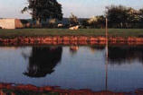
Alterations to the water table can have extreme effects such as in the summer of 1896 when
between 200 and 300 acres of land sank. Cracks 20-30 yards long and holes 3-4ft deep and 7ft
across appeared. This was blamed on Chelvey Pumping Station abstracting too much water. To
counteract this a dam was built on the River Yeo at Wemberham to hold back the water on the
moors. There was also a pumping station in Chapel Lane.
Given the current trend towards wetter winters and the consequent high water table, anything
that would add to the potential for flooding should be avoided.
Farms
It must not be forgotten that the fields are a green factory. Cattle and sheep predominate in this
area. There are dairy farms and beef and sheep rearing ones. Some cereal crops are grown, but
fields are mainly cut for hay and silage.
There are also agricultural contractors some of whom farm as well. There are concerns that if
farms cease to remain viable there will be increased pressure to allow building or further industrial
development.
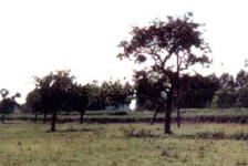
Orchards have also been diminishing. Some have been removed
including one at Court de Wyck, others have died off and not been
replaced. One remains near Oakfield, which still produces apples
and also provides a habitat for the Green and Lesser Spotted
Woodpeckers as well as owls. New orchards are being planted. A
cider apple orchard has been replanted on land at Brockley Way
where the old cottage stood, and a small orchard has been planted
at Walnut Bank.
Ponds
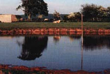
Ponds provide an important habitat for flora and fauna as well as
acting as natural reservoirs for excess water. There are more than
15 ponds and pools in Claverham. Many are natural but several
have been man-made, either to provide drinking water for
livestock, a habitat for wildlife or as a water feature. These include
one created ten years ago by Clevedon Gun Club on marshland
between Walnut Bank and the railway line.
More recently a wildlife pond has been created at Court de Wyck School. There are two ponds at
Hillsea one of which is a dew pond. Ponds at Claverham Green Farm were used by drovers who
stayed overnight to rest and water their animals and also for washing purposes - hence the name
'washing pound'.
Several ponds have been filled in, some deliberately others by natural processes. The decoy pool
near Little River which was created in 1750 is not shown on the 1841 Tythe Map, but five fields
have the word Decoy Pool in their names. Bungalows now cover the duck pond in the High Street.
The bog and adjacent marshland in Chapel Lane have also been filled in.
The loss of these natural reservoirs, which allow excess rainwater to seep away slowly, could be a
contributory cause of flooding such as that seen at the end of Chapel Lane in 2001. The loss of the
only bog area in Claverham has also denuded the village of important wildlife.
Trees
Nothing enhances a landscape more than trees. Although there is no large area of woodland in the
village it is rich in trees - not only in hedgerows and fields, but in private gardens as well.
One of the major changes to the look of the landscape has been the loss of thousands of majestic
Elms due to Dutch Elm disease. Semi-mature elms are still being lost today. However Claverham
still has many native trees, with ash and oak predominating on the higher ground, while pollarded
willows line the rhynes on the moors.
Several specimen trees already have Tree Preservation Orders (TPOs) on them. These include 13
trees at Court de Wyck (Claverham Ltd) namely a lime (which replaced a pine), Scots Pines,
Sycamores, Horse Chestnuts (two of which were planted by the daughters of the Millwards 90 years
ago) and a Holm Oak. The land also supports Copper Beech,
Walnuts, Somerset Firs, a 30-year-old Magnolia, 60-year-old
Mulberry and a Ginkgo Tree as well as the usual Ash etc.
In the High Street, a Willow and Silver Birch have TPOs, and a Lime
is included in a landscape order at Ivy Cottage. There is also a TPO
on a Walnut Tree in Claverham Park. Other important trees include
eleven Walnut trees at Claverham Court and the Chestnut tree at
Grove Farm, which is a third generation from a specimen tree between Henley Lane and Cadbury
Country Club.
Hedges
Hedges not only act as boundaries to fields and form wildlife habitats but they are living
connections to the past. To former generations, hedges were of great importance as a source of
food, fuel and medicine as well as acting as a shelter to livestock and crops, a soil stabilizer and a
windbreak.
Forming a complete wild life eco-system, half of our native mammals, all of our reptiles and a
fifth of the bird population can be found in the hedgerows. Over a thousand species of wild flowers
can also be found there - more varieties than in woods or on
heath lands.
Hedges still predominate in Claverham as boundaries to fields
and farms as well as edges to lanes. Remnants of these field
hedges can also be found in some of the residential areas.
Once a hedge has been created it is totally sustainable, enduring
year after year and increasing in diversity, and it is this diversity
which provides a clue to its origins. It has been calculated that the number of shrub species per 30-
yard hedge is roughly equal to its age in hundreds of years.
The hedge alongside the road at Walnut Bank has been verified as having Tudor origins from the
number of species in it. Many of the other hedges date back to the time of the Enclosure Acts of
the 18th and 19th centuries.
Part of the hedge in Meeting House Lane contains small leaf Lime, which is a living link with
Mesolithic times. A sticky, woodland tree, which is not normally used in hedges, it is an indicator of
a 'woodland ghost' where the hedge has been formed from trees growing in the original forest
which covered the area.
At one time hedges were closely protected and raids on them by parishioners were severely
punished and could carry the penalty of transportation.
Until 20 years ago, hedges were managed in a sustainable way by hand. Cutting and laying ensured
strong new growths. However, modern practices of annual flaying by mechanical cutters can kill a
hedge. Disease can enter through the jagged tears and the mulch of debris at the base of the
hedge can stop new growth.
Open Spaces
The only open space in the centre of the village is the Broadcroft
Playing Field.
Just outside the village fence is Cadbury Hill, part of which is
jointly managed by Yatton and Congresbury Parish Councils. The
nearest large open spaces are at Hangstones, Yatton and Cleeve
playing fields.
Claverham enjoys a diversity of scenic views both from Cadbury
Hill and across the moors. With its mixture of lanes, footpaths and the bridleway, there are many
attractive corners and vistas to delight walkers, cyclists and horse riders.
Employment [FIGURES IN THE EMPLOYMENT SECTION ARE FROM THE ORIGINAL REPORT IN
2000]
Local employment can be important in a village. It reduces the need to travel by car or public
transport, thereby cutting down on pollution and congestion. It can also provide opportunities for
part-time work for those with family commitments.
However, against that, businesses pull employees into the village from outside the area, increasing
local traffic. Delivery lorries on narrow country lanes can cause damage to the infrastructure.
Certain types of business can cause both noise and environmental pollution.
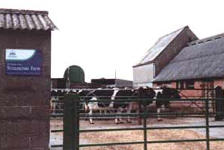
Claverham Ltd, situated at Court de Wyck, are part of a multinational organization. Claverham Ltd
is well established in the village, having moved on to the site in 1980. The land was previously
owned by The Imperial Tobacco Co. & prior to that was a tannery. [This factory has now closed
and houses have been built there].
The village has several other businesses, a small industrial estate, engineering companies and some
builders. There are also ten farms, three horticultural establishments and a retirement home.
Apart from agriculture, the major employer in Claverham in the 1851 census was the Court de
Wyck Tannery, which employed seven local people. Today out of a workforce of 380, Claverham
Ltd, on the same site, employs only five local people. [This factory has now closed]
As in 1851, the highest local workforce is still in agriculture and horticulture, with some 34 people
involved. The other major employers are the three shops and the six building firms. Court de Wyck
Primary School employs 12 local people but a further 17 come from outside the village.
The 35 businesses surveyed in the village showed that out of a combined workforce of 547
employees, only 101 come from the village. Interestingly, the 1851 census showed that there were
39 different occupations in the village at that time involving 143 people.
Transport & Travel
There is easy access, by car, to Bristol and Weston via the A370 and the M5 motorway. The area is
also served by buses. A train station in Yatton provides services to Bristol, Weston and beyond,
while five miles away is Bristol International Airport.
Of concern is the increase in the number of vehicles in the area and the speed of traffic in the
village and around the lanes. Claverham Road is becoming increasingly dangerous for parents
walking their children to school.
Leisure
Leisure facilities in the village have improved since the opening of
the Village Hall in 1999. Prior to that most village events were held
in the Church Room, adjacent to St Barnabas Church - a second-
hand wooden hut which was opened in 1920, closed in 1986 and has
since been demolished - however this was not suitable for the
majority of indoor games.
As well as providing a venue for various exercise classes, the new
hall is marked out for badminton and Claverham Village Hall could be available for table tennis and
other activities, if there is enough interest and appropriate clubs are formed.
However, in the village there is limited scope for outdoor games,
such as football, and villagers have to travel to Cleeve or Yatton for
such activities. Claverham Cricket Club, which draws members from
a wide area, is situated outside the village boundary in Yatton.
The other popular activities are walking, cycling and horse riding.
As well as the lanes round lower Claverham, the area is richly
served with footpaths. However there is only one bridleway, which
leads from Chapel Lane to Cadbury Hill and Cleeve.
Youth Facilities [no idea whether this section is still current].
Most people agree there should be more facilities for the youth of the village, but, there are a
variety of views as to what form these should take and where these facilities should be. Some
people feel that because of vandalism, no more facilities should be provided at all. There were
also fears expressed in the survey, that extra facilities would attract teenagers from outside the
village.
Because the equipment has been largely removed from Broadcroft Playing Fields the younger age
group needs a safe play area with swings etc. The parish council has money earmarked for this.
However, the older teenagers need more space for ball games etc. Currently many teenagers
attend the Yatton Youth Club in Rock Road.
Claverham Youth Project, which was set up in December 2000, is trying to raise money for an all
weather sports court. The group has been busy fundraising and has collected over £200 from discos
and car washing. They have also secured £1,000 of funding from the Police. Now they need an area
of land on which to build the sports court. [no idea whether this project is still ongoing].
Other youth groups such as Scouts, Cubs, Guides and Brownies, are well supported and have their
own hall.
Facilities for the Elderly and Disabled
All the public places, such as the shops, hall and churches are accessible to the disabled, but the
narrow, discontinuous pavements make it difficult for wheelchair access both round the village
and between Claverham and Yatton.
With no doctor or dentist in the village it is often difficult for the elderly to get to these facilities,
the nearest being in Yatton. There is a Community Bus service run by the Lions, which takes people
from Claverham to Yatton on a Thursday. Yatton Carers also provide transport to local hospitals,
doctors, etc.
Conclusion
There's no doubt that Claverham is a great place to live. There is a thriving community spirit,
which enabled a new village hall to be built. This in turn has brought back many of the village
activities, which were lost when the Church Room was condemned. These include the Harvest
Supper, the Senior Citizens tea party, the country market and various other entertainments.
We still have our Post Office [now a cafe], [now closed] Claverham Stores changed to a pizza
takeaway which is also now closed but we still have Melanie's the hairdressers. There is a primary
school and pre-school playgroups.
CONGRATULATIONS IF YOU HAVE REACHED THIS POINT ON THE PAGE AND THANK YOU FOR
READING IT ALL!


© 2025

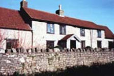
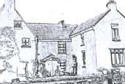
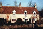
Claverham Court

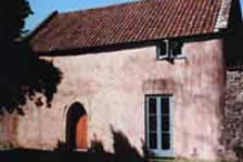
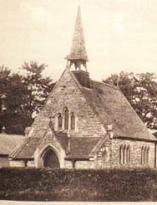
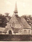
Court de Wyck Chapel


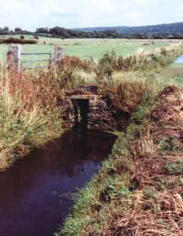
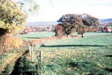
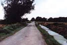
Claverham Drove

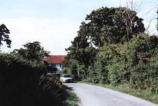
Top of High Street

Rose Farm

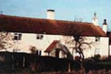
Home Farm, Lower Claverham


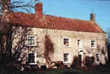
Chestnut Farm, Lower Claverham


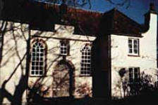
Sweet Briar Cottages

St Barnabas Church

Friends Meeting House

Curved Wall at Walnut Bank
Claverham Drove Under Water
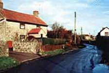
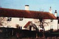
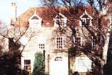
Streamcross Farm

Old orchard

Dew Pond at Hillsea
Hedges in Meeting House Lane


Trees at Claverham House

View from Cadbury Hill
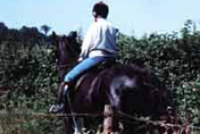
Horse riding, a popular activity

Claverham Village Hall
ABOUT CLAVERHAM
Claverham is a small village located just off the A370, half way between Bristol and Weston super Mare,
Somerset, in the UK.
•
Claverham has a Neighbourhood Plan (2016-2026) which you can view HERE
•
There is also a Facebook Group HERE
•
If you search Wikipedia for “Claverham” you get re-directed to a page about Yatton but it does contain
some basic information about the village.

CONTACT
For all website enquiries please - CLICK HERE TO EMAIL
Views expressed on linked websites do not necessarily reflect the
views of claverhamvillage.co.uk.
Click here for T&Cs
A booklet was produced in 2000-2001 which was the result of a comprehensive survey of the village in order to produce a Village Character
Statement. Much of content is shown below but please bear in mind that this was a document from the turn of the century and may now be out of
date. It’s a long page but just scroll down to read it all……………….

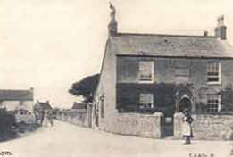
View up High Street from The Crossroads cl909
(Picture Courtesy of Richard Whittaker)

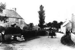
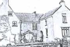
View along High Street towards St Barnabas Church - early 1900's (Picture courtesy of
Memories, St Nicholas Market, Bristol)


The Village
The village is centred on the High Street
where there is a Post Office [now closed],
a pizza takeaway [now closed] and
Melanie's Hairdressers; and the adjoining
Bishops Road where there is a Primary
School and a village hall.
St Barnabas Church is at the top of the
High Street and the Free Church is
situated in Claverham Road, a few
hundred yards from the cross roads. This
cross road, formed by the High Street,
Chapel Lane, Bishops Road and Claverham
Road is believed to be the site of the
ancient Stalling's Cross - the market cross
for Court de Wyck. (The former Chapel is
thought to stand on the original site).
Stalling's Cross may have been corrupted
to become Stream
Cross.
Originally a
farming hamlet,
the village acts as
a home to many commuters. However, it
still retains its rural heritage and is
surrounded by farms, horticultural
businesses, market gardens and a small
riding school. It is this patchwork of
farms, fields, footpaths and winding lanes
that gives Claverham its character.
As with many villages in North Somerset,
Claverham has a mixture of old local
families and new arrivals.
History
Claverham is probably named after the
clover fields which surrounded the village.
In the West Country, the word 'ham' does
not refer to a village or settlement, but is
a contraction of the word 'hamm' meaning
meadow.
It is situated roughly half way between
Weston-super-Mare and Bristol on the
plain between the rivers Kenn, to the
north, and Yeo to the south. Claverham is
roughly five miles from the Bristol
Channel as the crow flies.
The village has two distinct
geological sections. To the
south Cadbury Hill, a
limestone ridge, partly
overlaid with clay, rises to some 250 feet.
The rest of the area is a mixture of peat,
estuarine alluvium and low hills of sand
and gravel. The former swampy areas
between Hillsea, Claverham Court and
Claverham Road were drained by an
interconnecting series of rhynes in the
1700s.
The underlying geological structure has
determined the development pattern of
the village - but it is the impact of man,
allied to the natural environment, which
has given the surrounding countryside its
patchwork of fields, hedges, walls and
rhynes.
Formation of the Village
Claverham has probably been inhabited
from Stone Age times when the moors
would have been used for fishing and wild
fowling. Trenches cut in the 1970s at Kenn
revealed pieces of wood thought to have
come from a track-way across the swamp.
A Romano-British pot was found south of
the railway line at Hillsea and Saxon
pottery has also been found in the area.
Although not strictly speaking in
Claverham, there was a Roman Temple
and an Iron Age Fort on Cadbury Hill. Prior
to the Roman period (around 45AD) the
area was mainly used for grazing, fishing
and hunting. Drainage systems put in by
the Romans, however, established a
suitable environment for agriculture.
Early history is sketchy. Before 1066
Claverham was held by Gunhilda. After
the Norman Conquest it was held by the
Bishop of Bath and Wells. At the time of
the Doomsday survey, 'Claverham' was
home to one Lord, one slave, three
villagers and twelve smallholders. By 1450
there were 14 farms.
The village was
originally in two
hamlets or tithings.
The tithing of
'Claverham' was the
area now known as Lower Claverham and
centred round Claverham Court, while the
High Street area was called 'Week' and
centred round Court de Wyck. More
recently, a third hamlet has grown up in
the Stream Cross area. Claverham Court,
originally the old Court House, now a
farm, was built in the 15th century or
possibly even earlier.
A medieval two-light stone window still
exists at the back of the hall. The house
has a historic 17th century park and
gardens. To the east of the house stands
the original 15/16th century Tythe Barn,
with its central cart entry and weathered
buttresses. Nearby is a purpose built
sheep wash.
The original Court de Wyck was built
before 1338. Between 1660 and 1670 it
was enlarged and at the beginning of the
18th century it was considered one of the
most magnificent properties in the area.
However by 1814 it was virtually
uninhabitable and was pulled down
leaving only the l4th century chapel and
the tythe barn intact.
The tythe barn was
converted into a
tannery in 1840. In 1970
it was taken over by
The Imperial Tobacco Co. and its
trademark tall chimney, a landmark for
miles around, was demolished in the mid-
1970s. The barn was twice gutted by fire -
in 1898 and 1928. After the latter fire the
south fascia was reconstructed from the
original stone. Opposite the original
entrance to Court de Wyck was the
farmhouse of Bishop's Farm, first recorded
in 1799 as being let to Edward Ash. By
1821 the present house had been built in
the "homeground".
Over the next 200 years farm houses and
cottages were slowly added, but the next
major change came with the drainage of
the low lying, peaty land between
Claverham Court and Little River. In
1750/1 a private agreement led to the
early enclosure of some 200 acres at
Claverham Common. The enclosure was
allocated to people in proportion to the
number of shares (or grazing rights) they
held on the Common. The area known as
Hare Mead, some 32 acres, was made into
a Decoy Pool. The land was divided into
fields enclosed by rhynes, which act as
boundaries, watering for livestock and a
drainage system.
The Parliamentary
Enclosure Act caused
further drainage to
take place. During
1810-1815 Kenn Moor
was drained to the west of Kenn Moor
Gate (there literally was a gate here). It
was at this time that the droves, including
Claverham Drove (originally called
Claverham Road) were laid out across the
moors. Because of the peat foundation,
the roads are laid on faggots, which gives
them their characteristic springy feel.
The census of 1851
shows there were 71
dwellings in the village
and 14 farms. Out of
476 inhabitants a
quarter were employed in farming. A few
were coal miners, who may have worked
down the Claverham mine. There were
two shops - a butchers and a general
store. Although there was no inn there
was a beer house keeper near Claverham
Green Farm and a cider house keeper at
Mead Mills at the end of Hunt's Lane. The
picture "The top of the High Street" shows
the area as it is today, compared with the
picture the early 1900's shown earlier.
Eighteen properties were situated
between Cottage Farm at the top of the
High Street and Streamcross Villa. Several
remain including Court de Wyck Cottages.
Historic Properties
Claverham is richly endowed with historic
properties. Claverham Court is believed to
be the earliest building still existing, but
this and some of the other farms were
probably built on the sites of even older
properties. They include:
Rose Farm in Stream
Cross, was originally a
medieval house with an
open hearth. The
ceiling, fireplace and
stairs were probably added in the l6th
century.
Home Farm (formerly
Foord Farm) A 15th
century single storey
open hall house, with
the smoke escaping
through a hole in the thatched roof. The
blackened roof timbers still remain, but
the thatched roof was replaced in the mid
20th century. Ceiling, fireplaces and stairs
were added in the l6th century.
Lower Farm (formerly Old Farm), Jasmine
Lane. This property dates from mid l6th
Century, is built on the same plan and
construction as Home Farm and Rose
Farm. Jasmine Lane was originally called
Old Farm Lane. Grove Farm, Brockley
Way, is late l6th/early 17th century with
later alterations and additions. It is built
of stone and has two large, external
chimneystacks. The gable porch has a very
old studded front door with raised hinges
and the doorframe has been cut to allow
barrels to be taken into the house.
Claverham Green Farm, Brockley Way: The
date on the chimney is 1721, but it is
probably of an earlier construction with
19th century alterations. Built of stone
and rendered, the roof is pantiled with
brick chimneys.
Claverham House, Stream Cross: Built in
1744 with mid 19th century alterations, it
is built of stone with a limestone dressing.
It has an interesting 19th century porch
with pilasters on pedestals. In the 18th
century gardens there is a ha-ha, as have
at least three other properties in the
village. A ha-ha is a ditch, often with a
low wall inside it, which divides areas of
land and forms a barrier to animals
without interrupting the view.
Chestnut Farm,
Lower Claverham,
The earliest part is
mid 17th century.
It was refronted in
the 18th century and has early 19th
century alterations. Built of stone and
rendered, it has a pantiled roof and a fine
studded door with hinge straps.
Manor Farm, Stream Cross, appears to be
early 17th century, but the hall and stairs
in a turret could mean an earlier date.
Built of stone and rendered, with a
pantiled roof and gabled chimneystacks, it
has 18th century alterations.
Oakfield, Meeting House Lane: Built in the
early 17th century, it was remodelled in
the 18th century and the rear wing was
added in the early 19th century.
Construction is stone and render.
Cottage Farm, Brockley Way: Built before
1800 of stone and rendered, the front has
recently been cleared of render and re-
pointed. Originally a single thatched
building, it has been added to at the front
and rear. In the 19th century there was a
coalmine behind the house. The shaft
reappeared during the last war but was
filled in to prevent accidents.
White Cottage, Jasmine Lane: An early
19th century front, probably of a much
older building, with 20th century
alterations. Attached at an angle and
incorporated into the house is a former
pigsty. The house is stone, rendered and
painted white with a pantiled roof.
The Post Office, High Street: 19th century
with the main door originally opening at
the side onto the road. Stone and
rendered.
Sweet Briar Cottages, Lower Claverham:
Older than 1650, when the deeds show the
property changed
hands. Stone and
rendered.
Streamcross Villa,
Claverham Road:
Probably late 18th century (shown on a
survey map of 1799). It is one of the
oldest properties on Claverham Road.
Until fairly recently it was a general shop.
Stone built and rendered.
Churches
The earliest known church (or free
chapel), which was dedicated to St
Swithin, was built near Claverham Court
before 1326. All traces of the building
disappeared in the l600s, but it is thought
to have been built on the field called
Chappie Hays.
The Friends
Meeting House, in
Meeting House
Lane, was built on
a half-acre plot
given to the
Friends by Richard Dawson in 1673. This
was at a time when persecution of the
Quakers was intense. After the Act of
Toleration the Friends obtained a licence
to hold meetings in a named Meeting
House. By 1729 the numbers had grown
and the House was rebuilt and extended
to create an attractive natural stone
property. (In that same year one of the
Friends, Richard Durban left a bequest in
trust for a school in Yatton for poor
children). In 1932 the property was given
to the Friends Historical Society to
administer. In 1991 a Claverham Trust was
set up to buy back the property and
undertake a major building project
including re-rendering the outside. Behind
the property is a burial ground.
The Methodist Church at the end of
Chapel Lane was built in 1867 It was
closed in 1972 and converted into two
properties in 1978.
St. Barnabas Church,
which was originally
called the Mission Room
and Busy Bee, was built
in 1879 on land donated
by John Cox and family. A
daughter church of St
Mary's, Yatton, it was opened to counter
the three 'public houses' in the remoter
parts of Claverham.
The Free Evangelical Church at the corner
of Streamcross was built in 1927 - only
eight months after parishioners, who did
not agree with the Minister at the
Methodist Church, decided to form their
own group. A clubroom was later added at
the rear.
Barns and Walls
The village is also rich in old farm
buildings, barns and walls made of local
stone. Mellowed over the centuries, they
add to the texture of the village. The
tythe barn at Claverham Court is
15th/l6th century construction, 17 metres
long and stands 7 metres high.
A variety of buildings at Rose Farm show
the transition from local stone used in the
18th and 19th centuries to the brick ones
of the early part of the 20th century. At
Chestnut Farm, the range of natural stone
buildings, which Include a cider house,
run along the side of the road for 80
metres.
Several redundant barns have been
converted to attractive homes, thus
preserving them. The new village hall has
been built in the style of a Somerset barn
to ensure it blends in with the adjacent
historic buildings.
There are also
many 'stand alone'
stonewalls, the
most important
being those at
Claverham House,
Court de Wyck, Walnut Bank and 'Parman'.
The curved garden wall at Walnut Bank is
probably the highest at three metres. The
walls adjoining the chapel at Court de
Wyck are probably the oldest in the
village. There are several walled gardens
in Claverham. Although the garden wall at
Green Farm has been demolished, the
wall outside the refurbished Yew Tree
Cottages has been rebuilt using the
original stone.
Up until 1900 the majority of properties in
the village were built of dressed stone or
limestone rubble and render, with gables.
Recently the render has been removed
from some properties and the stonework
re-pointed.
Development
The modern
development in the
village started in
the 1930's with
local authority
housing along
Claverham Road.
These followed the
traditional style of
render and gables.
Further local
authority housing
followed in
Broadcroft Avenue,
then around twenty
years later in
Claverham Park. Again they followed the
village style. The last local authority
homes to be added were the retirement
bungalows in 1984, but this time they
were brick built.
The first private housing developments
started in the 1960s. Over the next ten
years, Whitehouse Road, Hollowmead
Close, Franklin's Way, Chestnut Drive,
Dunsters Road and Anvil Road were built.
These have followed a variety of styles
and are mainly of brick or imitation
natural stone. None of these estates
exceeded 35 in number and the ten-year
time scale allowed them to be absorbed
into the village.
In 1997 five dark red brick houses in
Orchard Court were built. This is a
sensitive site right in the heart of the
village. Originally the developers wanted
to pull down the three derelict cottages
known as Yew Tree House, which dates
from the l6th century or earlier. However
villagers felt that this would destroy the
character of the High Street and after a
sustained campaign the planners agreed
they should be retained and renovated.
Strikingly, individual houses which have
been built over the past five years, have
stuck to the village style of rendered
cottage.
There are a wide variety of properties
along Claverham Road and the High
Street; all built at different times and
with varying styles, however, several
incorporate gables.
Natural Environment
The attractive network of lanes,
bridleways and footpaths, which allows
access to the countryside surrounding the
village, is one of the reasons why so many
people like living in Claverham. Most
properties either look out onto fields or
are within easy reach of them. Apart from
Claverham Road, all access roads to the
village are through farmland.
Sites of Special Scientific Interest (SSSI):
The moors are more than an attractive
place to walk - they are a vital
conservation area on our doorstep. The
importance of the natural flora and fauna
of the moors was recognized in 1995 when
a large area - from Nailsea Wall across
Kenn Moor to the railway line - was
designated as a Site of Special Scientific
Interest.
The local area has undergone many
changes since the end of the last ice age.
Changes in sea levels have laid down
layers of silt and peat. Clay occurs to the
west of the area, and in some places this
has become mixed with the peat. The
varying soil types and farming practices,
along with the drainage systems, have
resulted in a wide range of rhynes and
ditches, each supporting exceptionally
rich plant communities such as Frogbit
and Unbranched Bur-reed as well as the
nationally scarce Hairlike and Fern
Pondweed and Whorled Water-milfoil.
Many emergent species are also present
such as Tubular Water-dropwort and the
Flowering Rush. In some places the
brackish nature of the area, before
drainage, is still reflected in some of the
plants such as Club-rush and Grey Club-
rush.
Some of the less frequently dredged
ditches are dominated by extensive stands
of yellow Iris, Reed Sweet Grass and
Common Reed while the banks support
Ragged Robin, Marsh Marigolds and
Creeping Jenny.
There is an equally diverse invertebrate
fauna, many of them now nationally rare,
including the Hairy Dragonfly and the
Variable Damselfly, Britain's largest Water
Beetle - the Great Silver Water Beetle -
the Pea Mussel and the Soldier Ply.
Amphibians such as frogs, toads and newts
all breed in the area along with reptiles
such as grass snakes and slow worms.
Of the bird population, the Bewick Swans
and herons predominate, but curlews,
skylarks, lapwings, kestrels, buzzards,
mallards, moorhens and the occasional
kingfisher can all be seen, as well as sea
birds, woodpeckers, blackbirds and song
thrushes (though these are sadly in
decline).
Mammals include foxes, badgers, rabbits,
hares, grey squirrels, roe deer, and bats.
The complex web of ditches drain into the
Little River, Westmead Rhyne, Blackditch
Rhyne and Claverham Rhyne (Tan Ditch).
These are connected to the River Kenn
and Blind Yeo via Claverham Drove Rhyne
and Decoy Pool Rhyne.
The management
of this diverse
habitat is finely
balanced and
current practice
has evolved over several generations of
drainage engineers, farmers and, more
recently, conservationists (the water-
logged structure of the Inner Moors is of
archaeological interest as these conditions
preserve organic remains of wood and
leather). In the past, those holding rights
of common on Kenn Moor were obliged to
maintain the rhynes and rivers and they
could be fined for neglecting their duties
or damaging the banks.
Alterations to the water table can have
extreme effects such as in the summer of
1896 when between 200 and 300 acres of
land sank. Cracks 20-30 yards long and
holes 3-4ft deep and 7ft across appeared.
This was blamed on Chelvey Pumping
Station abstracting too much water. To
counteract this a dam was built on the
River Yeo at Wemberham to hold back the
water on the moors. There was also a
pumping station in Chapel Lane.
Given the current trend towards wetter
winters and the consequent high water
table, anything that would add to the
potential for flooding should be avoided.
Farms
It must not be forgotten that the fields
are a green factory. Cattle and sheep
predominate in this area. There are dairy
farms and beef and sheep rearing ones.
Some cereal crops are grown, but fields
are mainly cut for hay and silage.
There are also agricultural contractors
some of whom farm as well. There are
concerns that if farms cease to remain
viable there will be increased pressure to
allow building or further industrial
development.
Orchards have also
been diminishing.
Some have been
removed including
one at Court de
Wyck, others have died off and not been
replaced. One remains near Oakfield,
which still produces apples and also
provides a habitat for the Green and
Lesser Spotted Woodpeckers as well as
owls. New orchards are being planted. A
cider apple orchard has been replanted on
land at Brockley Way where the old
cottage stood, and a small orchard has
been planted at Walnut Bank.
Ponds
Ponds provide an
important habitat
for flora and fauna
as well as acting as
natural reservoirs
for excess water.
There are more than 15 ponds and pools in
Claverham. Many are natural but several
have been man-made, either to provide
drinking water for livestock, a habitat for
wildlife or as a water feature. These
include one created ten years ago by
Clevedon Gun Club on marshland between
Walnut Bank and the railway line.
More recently a wildlife pond has been
created at Court de Wyck School. There
are two ponds at Hillsea one of which is a
dew pond. Ponds at Claverham Green
Farm were used by drovers who stayed
overnight to rest and water their animals
and also for washing purposes - hence the
name 'washing pound'.
Several ponds have been filled in, some
deliberately others by natural processes.
The decoy pool near Little River which
was created in 1750 is not shown on the
1841 Tythe Map, but five fields have the
word Decoy Pool in their names.
Bungalows now cover the duck pond in the
High Street. The bog and adjacent
marshland in Chapel Lane have also been
filled in.
The loss of these natural reservoirs, which
allow excess rainwater to seep away
slowly, could be a contributory cause of
flooding such as that seen at the end of
Chapel Lane in 2001. The loss of the only
bog area in Claverham has also denuded
the village of important wildlife.
Trees
Nothing enhances a landscape more than
trees. Although there is no large area of
woodland in the village it is rich in trees -
not only in hedgerows and fields, but in
private gardens as well.
One of the major changes to the look of
the landscape has been the loss of
thousands of majestic Elms due to Dutch
Elm disease. Semi-mature elms are still
being lost today. However Claverham still
has many native trees, with ash and oak
predominating on the higher ground,
while pollarded willows line the rhynes on
the moors.
Several specimen trees already have Tree
Preservation Orders (TPOs) on them.
These include 13 trees at Court de Wyck
(Claverham Ltd) namely a lime (which
replaced a pine), Scots Pines, Sycamores,
Horse Chestnuts (two of which were
planted by the daughters of the Millwards
90 years ago) and a Holm Oak. The land
also supports Copper Beech, Walnuts,
Somerset Firs, a 30-year-old Magnolia, 60-
year-old Mulberry and a Ginkgo Tree as
well as the usual
Ash etc.
In the High Street,
a Willow and
Silver Birch have
TPOs, and a Lime is included in a
landscape order at Ivy Cottage. There is
also a TPO on a Walnut Tree in Claverham
Park. Other important trees include
eleven Walnut trees at Claverham Court
and the Chestnut tree at Grove Farm,
which is a third generation from a
specimen tree between Henley Lane and
Cadbury Country Club.
Hedges
Hedges not only act as boundaries to
fields and form wildlife habitats but they
are living connections to the past. To
former generations, hedges were of great
importance as a source of food, fuel and
medicine as well as acting as a shelter to
livestock and crops, a soil stabilizer and a
windbreak.
Forming a complete wild life eco-system,
half of our native mammals, all of our
reptiles and a fifth of the bird population
can be found in the hedgerows. Over a
thousand species of wild flowers can also
be found there - more varieties than in
woods or on heath lands.
Hedges still
predominate in
Claverham as
boundaries to fields
and farms as well
as edges to lanes.
Remnants of these field hedges can also
be found in some of the residential areas.
Once a hedge has been created it is
totally sustainable, enduring year after
year and increasing in diversity, and it is
this diversity which provides a clue to its
origins. It has been calculated that the
number of shrub species per 30-yard
hedge is roughly equal to its age in
hundreds of years.
The hedge alongside the road at Walnut
Bank has been verified as having Tudor
origins from the number of species in it.
Many of the other hedges date back to the
time of the Enclosure Acts of the 18th and
19th centuries.
Part of the hedge in Meeting House Lane
contains small leaf Lime, which is a living
link with Mesolithic times. A sticky,
woodland tree, which is not normally used
in hedges, it is an indicator of a 'woodland
ghost' where the hedge has been formed
from trees growing in the original forest
which covered the area.
At one time hedges were closely
protected and raids on them by
parishioners were severely punished and
could carry the penalty of transportation.
Until 20 years ago, hedges were managed
in a sustainable way by hand. Cutting and
laying ensured strong new growths.
However, modern practices of annual
flaying by mechanical cutters can kill a
hedge. Disease can enter through the
jagged tears and the mulch of debris at
the base of the hedge can stop new
growth.
Open Spaces
The only open space in the centre of the
village is the Broadcroft Playing Field.
Just outside the
village fence is
Cadbury Hill, part
of which is jointly
managed by Yatton
and Congresbury
Parish Councils. The nearest large open
spaces are at Hangstones, Yatton and
Cleeve playing fields.
Claverham enjoys a diversity of scenic
views both from Cadbury Hill and across
the moors. With its mixture of lanes,
footpaths and the bridleway, there are
many attractive corners and vistas to
delight walkers, cyclists and horse riders.
Employment [FIGURES IN THE
EMPLOYMENT SECTION ARE FROM THE
ORIGINAL REPORT IN 2000]
Local employment can be important in a
village. It reduces the need to travel by
car or public transport, thereby cutting
down on pollution and congestion. It can
also provide opportunities for part-time
work for those with family commitments.
However, against that, businesses pull
employees into the village from outside
the area, increasing local traffic. Delivery
lorries on narrow country lanes can cause
damage to the infrastructure. Certain
types of business can cause both noise and
environmental pollution.
Claverham Ltd, situated at Court de
Wyck, are part of a multinational
organization. Claverham Ltd is well
established in the village, having moved
on to the site in 1980. The land was
previously owned by The Imperial Tobacco
Co. & prior to that was a tannery. [This
factory has now closed and houses have
been built there].
The village has several other businesses, a
small industrial estate, engineering
companies and some builders. There are
also ten farms, three horticultural
establishments and a retirement home.
Apart from agriculture, the major
employer in Claverham in the 1851 census
was the Court de Wyck Tannery, which
employed seven local people. Today out of
a workforce of 380, Claverham Ltd, on the
same site, employs only five local people.
[This factory has now closed]
As in 1851, the highest local workforce is
still in agriculture and horticulture, with
some 34 people involved. The other major
employers are the three shops and the six
building firms. Court de Wyck Primary
School employs 12 local people but a
further 17 come from outside the village.
The 35 businesses surveyed in the village
showed that out of a combined workforce
of 547 employees, only 101 come from the
village. Interestingly, the 1851 census
showed that there were 39 different
occupations in the village at that time
involving 143 people.
Transport & Travel
There is easy access, by car, to Bristol and
Weston via the A370 and the M5
motorway. The area is also served by
buses. A train station in Yatton provides
services to Bristol, Weston and beyond,
while five miles away is Bristol
International Airport.
Of concern is the increase in the number
of vehicles in the area and the speed of
traffic in the village and around the lanes.
Claverham Road is becoming increasingly
dangerous for parents walking their
children to school.
Leisure
Leisure facilities in
the village have
improved since the
opening of the
Village Hall in
1999. Prior to that most village events
were held in the Church Room, adjacent
to St Barnabas Church - a second-hand
wooden hut which was opened in 1920,
closed in 1986 and has since been
demolished - however this was not
suitable for the majority of indoor games.
As well as providing a venue for various
exercise classes, the new hall is marked
out for badminton and Claverham Village
Hall could be available for table tennis
and other activities, if there is enough
interest and appropriate clubs are
formed.
However, in the village there is limited
scope for outdoor games, such as football,
and villagers have to travel to Cleeve or
Yatton for such activities. Claverham
Cricket Club, which draws members from
a wide area, is situated outside the village
boundary in Yatton.
The other popular activities are walking,
cycling and horse riding. As well as the
lanes round lower
Claverham, the
area is richly
served with
footpaths. However
there is only one
bridleway, which leads from Chapel Lane
to Cadbury Hill and Cleeve.
Youth Facilities [no idea whether this
section is still current].
Most people agree there should be more
facilities for the youth of the village, but,
there are a variety of views as to what
form these should take and where these
facilities should be. Some people feel that
because of vandalism, no more facilities
should be provided at all. There were also
fears expressed in the survey, that extra
facilities would attract teenagers from
outside the village.
Because the equipment has been largely
removed from Broadcroft Playing Fields
the younger age group needs a safe play
area with swings etc. The parish council
has money earmarked for this. However,
the older teenagers need more space for
ball games etc. Currently many teenagers
attend the Yatton Youth Club in Rock
Road.
Claverham Youth Project, which was set
up in December 2000, is trying to raise
money for an all weather sports court.
The group has been busy fundraising and
has collected over £200 from discos and
car washing. They have also secured
£1,000 of funding from the Police. Now
they need an area of land on which to
build the sports court. [no idea whether
this project is still ongoing].
Other youth groups such as Scouts, Cubs,
Guides and Brownies, are well supported
and have their own hall.
Facilities for the Elderly and Disabled
All the public places, such as the shops,
hall and churches are accessible to the
disabled, but the narrow, discontinuous
pavements make it difficult for wheelchair
access both round the village and between
Claverham and Yatton.
With no doctor or dentist in the village it
is often difficult for the elderly to get to
these facilities, the nearest being in
Yatton. There is a Community Bus service
run by the Lions, which takes people from
Claverham to Yatton on a Thursday. Yatton
Carers also provide transport to local
hospitals, doctors, etc.
Conclusion
There's no doubt that Claverham is a great
place to live. There is a thriving
community spirit, which enabled a new
village hall to be built. This in turn has
brought back many of the village
activities, which were lost when the
Church Room was condemned. These
include the Harvest Supper, the Senior
Citizens tea party, the country market and
various other entertainments.
We still have our Post Office [now a cafe],
[now closed] Claverham Stores changed to
a pizza takeaway which is also now closed
but we still have Melanie's the
hairdressers. There is a primary school
and pre-school playgroups.
CONGRATULATIONS IF YOU HAVE
REACHED THIS POINT ON THE PAGE AND
THANK YOU FOR READING IT ALL!


Claverham Court


Court de Wyck Chapel

Claverham Drove


Top of High Street


View along High Street towards St Barnabas Church -
early 1900's (Picture courtesy of Memories, St
Nicholas Market, Bristol)


Rose Farm

Home Farm, Lower Claverham

Chestnut Farm, Lower Claverham

Sweet Briar Cottages

St Barnabas Church


Friends Meeting House

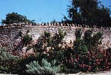
Curved Wall at Walnut Bank

Claverham Drove Under Water

Old orchard

Dew Pond at Hillsea
Hedges in Meeting House Lane
Trees at Claverham House

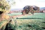
View from Cadbury Hill
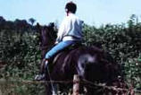
Horse riding, a popular activity

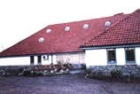
Claverham Village Hall
ABOUT CLAVERHAM
Claverham is a small village located just off
the A370, half way between Bristol and
Weston super Mare, Somerset, in the UK.
•
Claverham has a Neighbourhood Plan
(2016-2026) which you can view HERE
•
There is also a Facebook Group HERE
•
If you search Wikipedia for “Claverham”
you get re-directed to a page about
Yatton but it does contain some basic
information about the village.

CONTACT
For all website enquiries please - CLICK HERE TO EMAIL
Views expressed on linked websites do not necessarily reflect
the views of claverhamvillage.co.uk.Views expressed on linked
websites do not necessarily reflect the views of
claverhamvillage.co.uk.
Click here for T&Cs
A booklet was produced in 2000-2001 which was the
result of a comprehensive survey of the village in
order to produce a Village Character Statement. Much
of content is shown below but please bear in mind
that this was a document from the turn of the century
and may now be out of date. It’s a long page but just
scroll down to read it all……………….

